Arcnem OrbitOrbital Briefing for Data Centers and Commodities

Latest orbital brief

Macro shifts are visible across Orbit's full weekly watchlist.

This combined brief tracks 8 macro-scale sites, with the clearest visible changes at Loudoun Data Center Alley and Memphis Data Center Campus.

Sites tracked

8 sites

Coverage window

May 17 to May 18

Update cadence

May 18, 1:32 PM

Orbit pulse

  • Data centers: Continued Large-Scale Construction at Loudoun Data Center Alley with Expanded Electrical Infrastructure
  • Data centers: Major Construction Progress at Memphis Data Center Campus with Visible Utility Infrastructure Expansion
  • Data centers: New Albany Data Center Cluster Shows Significant Construction Progress and Infrastructure Expansion

Major changes

5 sites

Sites to watch

0 sites

No major shift

3 sites

Tracked sites

The latest view across every tracked site.

Orbit blends data-center campuses with macro commodity supply nodes so the landing page surfaces the most important visible change across the full watchlist.

Loudoun Data Center Alley true-color satellite scene captured on 2026-05-17
Data Centers
Major change

High confidence

Loudoun Data Center Alley

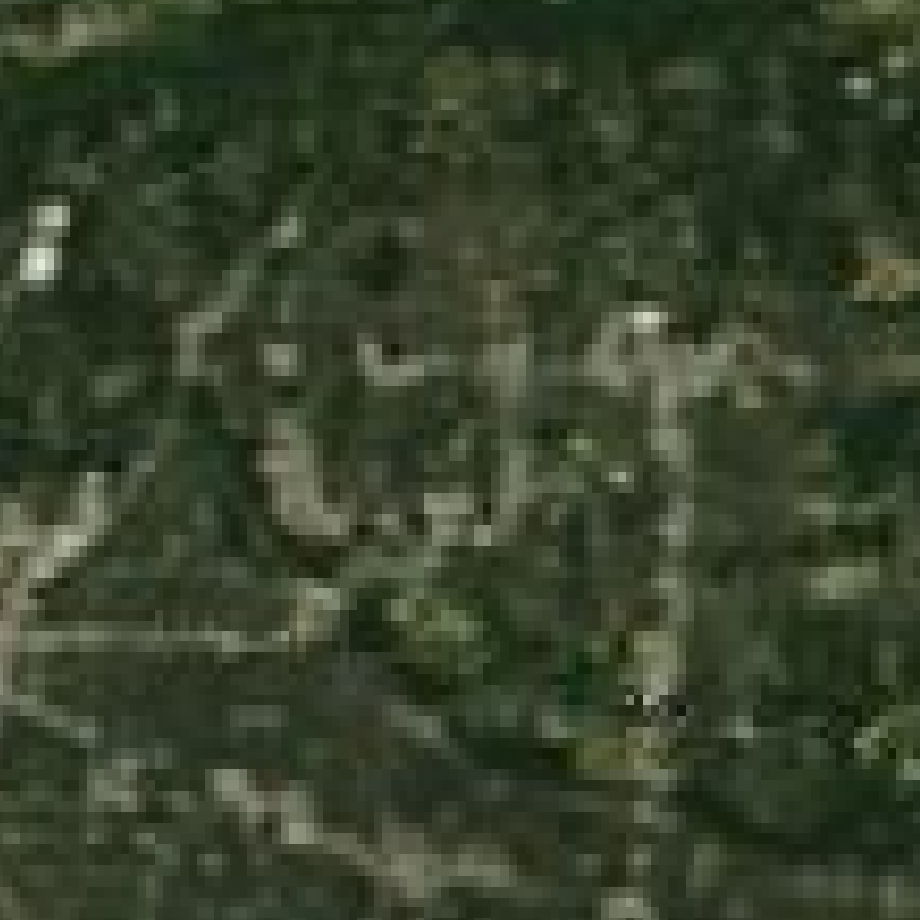
Loudoun County, Virginia · Multi-operator cluster · Data center · May 17 vs Apr 20

Continued Large-Scale Construction at Loudoun Data Center Alley with Expanded Electrical Infrastructure

Significant new building foundations and extensive utility trenches and electrical infrastructure installation observed compared to baseline imagery.

What changedSince the baseline on 2026-04-20, the site shows additional building pads and expanded electrical infrastructure including substations and utility trenches, indicating accelerated development of a hyperscale data center campus.

Why it mattersThis large-scale construction and electrical infrastructure expansion reflects the ongoing rapid growth of hyperscale data centers in Loudoun County, Virginia, a key U.S. data center hub. The development aligns with broader regional and national trends of increasing power demand and grid strain driven by AI and cloud computing facilities, underscoring the importance of transmission upgrades and regulatory oversight.

Athabasca Oil Sands Corridor true-color satellite scene captured on 2026-05-17
Commodities
No material change

High confidence

Athabasca Oil Sands Corridor

Alberta, Canada · Multi-operator corridor · Surface mine · May 17 vs Apr 20

No Major Visible Expansion or New Tailings Pond Growth at Athabasca Oil Sands Corridor in May 2026

Satellite imagery from May 17, 2026, compared to baseline imagery from April 20, 2026, shows no large-scale changes in open-pit mine footprint, tailings pond extent, or new land disturbance within the Athabasca Oil Sands Corridor. The landscape is snow-covered with some exposed ground patches, but no visible expansion of mining or tailings infrastructure is evident.

What changedNo significant increase in open-pit mining area or tailings pond size; no new large-scale land disturbance detected. The main difference is seasonal snow cover in the current image versus dry conditions in the baseline image.

Why it mattersStable surface footprint suggests no immediate escalation in bitumen extraction activities or tailings pond risk in this period. This is relevant given ongoing Indigenous coalition concerns about tailings risks and the broader context of Canadian oil sands development. Monitoring remains important for early detection of any future expansions or environmental impacts.

Memphis Data Center Campus true-color satellite scene captured on 2026-05-17
Data Centers
Major change

High confidence

Memphis Data Center Campus

Memphis, Tennessee · Hyperscale campus · Data center · May 17 vs Apr 20

Major Construction Progress at Memphis Data Center Campus with Visible Utility Infrastructure Expansion

Significant new building shells, extensive road networks, and visible power infrastructure have emerged at the Memphis Data Center Campus since the baseline, transforming the site from a dense forest with minimal clearing to a large-scale data center construction zone.

What changedThe baseline image showed dense forest with only faint clearing and no identifiable data center structures or utility infrastructure. The current image reveals multiple large buildings under construction, extensive road networks, and visible power lines and access roads supporting the campus.

Why it mattersThis large-scale construction and utility infrastructure development indicates rapid campus buildout consistent with hyperscale data center expansion. The visible power infrastructure aligns with recent regulatory changes enabling self-powering data centers in Tennessee, highlighting the site's strategic importance and potential impact on regional power demand and logistics.

Escondida Copper Complex true-color satellite scene captured on 2026-05-17
Commodities
No material change

High confidence

Escondida Copper Complex

Antofagasta Region, Chile · BHP-led operation · Surface mine · May 17 vs Apr 19

No visible large-scale surface mine expansion or waste-rock footprint growth at Escondida Copper Complex in May 2026

Comparison of MODIS true-color satellite imagery from 2026-04-19 baseline and 2026-05-17 observation shows no discernible changes in open-pit size, waste-rock piles, or tailings footprint at the Escondida Copper Complex. The recent image is dominated by snow cover on surrounding mountains, limiting visibility of surface mine features.

What changedNo visible expansion of open-pit mining areas or growth in waste-rock or tailings storage facilities. No major earthmoving or new land disturbance detected at macro scale.

Why it mattersStable surface footprint suggests no recent large-scale mining expansion or new waste disposal activities, consistent with ongoing steady production reported by BHP. Snow cover may temporarily obscure detailed surface changes, so continued monitoring is recommended to detect any future expansions or environmental impacts.

New Albany Data Center Cluster true-color satellite scene captured on 2026-05-17
Data Centers
Major change

High confidence

New Albany Data Center Cluster

New Albany, Ohio · Hyperscale cluster · Data center · May 17 vs Apr 20

New Albany Data Center Cluster Shows Significant Construction Progress and Infrastructure Expansion

Satellite imagery from May 17, 2026, reveals notable new concrete slabs, expanded building foundations, and upgraded access roads compared to the baseline image from April 20, 2026. Additionally, visible utility infrastructure such as substations and power lines have expanded, indicating scaling out of the hyperscale data center cluster.

What changedCompared to the baseline, there is clear evidence of new building foundations and concrete slabs completed, expanded staging and cleared land areas, and upgraded or additional access roads. Utility infrastructure footprints, including substations and power lines, have increased in size or number, supporting the cluster's growth.

Why it mattersThis visible expansion aligns with Ohio's significant tax incentives for data center development and the regional utility provider's forecasted doubling of power demand by 2030 largely driven by data centers. The rapid construction progress at this hyperscale cluster indicates strong momentum in data center capacity growth in New Albany, Ohio, which has implications for regional power infrastructure and economic development.

Salar de Atacama Lithium Ponds true-color satellite scene captured on 2026-05-17
Commodities
Major change

High confidence

Salar de Atacama Lithium Ponds

Antofagasta Region, Chile · Multi-operator salar · Evaporation ponds · May 17 vs Apr 19

Significant Drying Observed in Salar de Atacama Lithium Ponds Between April and May 2026

Satellite imagery comparison from April 19 to May 17, 2026, shows a transition from a dry, barren landscape with bright white salt flats to a large, mostly dry reservoir exhibiting visible sediment patterns indicative of low water levels.

What changedThe baseline image depicted three distinct bright white salt flats or mineral deposits, consistent with high mineral concentration and evaporation. The current image reveals a large reservoir area with sediment patterns, suggesting a shift in surface water distribution and a reduction in pond water coverage or depth.

Why it mattersThis visible reduction in water levels and alteration in evaporation pond surface patterns signals potential water scarcity challenges affecting lithium brine processing operations. Given the critical role of these ponds in lithium extraction, such changes could impact production capacity or operational strategies. Additionally, the drying trend aligns with broader concerns about water resource stress in the region, which is significant for stakeholders monitoring lithium supply chain stability amid rising global demand.

Phoenix West Valley Data Centers true-color satellite scene captured on 2026-05-17
Data Centers
Major change

High confidence

Phoenix West Valley Data Centers

West Valley, Arizona · Multi-operator cluster · Data center · May 17 vs Apr 20

Significant Construction Progress at Phoenix West Valley Data Centers Campus

Between April 20 and May 17, 2026, satellite imagery shows a clear transition from early-stage land preparation with scattered structures and dirt roads to a large-scale data center construction site featuring multiple building foundations, adjacent utility lines, and access roads.

What changedThe site has advanced from partial development with no visible data center infrastructure to extensive campus-scale construction activity including multiple building pads and utility tie-ins, indicating accelerated development.

Why it mattersThis visible expansion and infrastructure development at a major multi-operator data center cluster in the West Valley of Arizona underscores the ongoing growth of hyperscale data center capacity in a region facing community pushback and power infrastructure challenges, as reported in recent news. The scale of construction suggests continued investment despite local opposition and highlights the importance of monitoring power and water-cooling infrastructure developments at desert sites.

Port Hedland Iron Ore Hub true-color satellite scene captured on 2026-05-18
Commodities
No material change

High confidence

Port Hedland Iron Ore Hub

Pilbara, Western Australia · Pilbara export hub · Export port · May 18 vs Apr 20

No visible large-scale changes at Port Hedland Iron Ore Hub in May 2026 imagery

Satellite imagery from 18 May 2026 shows no visible expansion or reduction in stockpile yards, berth occupancy, or terminal infrastructure compared to baseline imagery from 20 April 2026. The area remains dominated by natural coastal features with limited human-made structures visible.

What changedNo discernible changes in port infrastructure, stockpile yard footprint, berth occupancy, or land reclamation activities between baseline and current observations.

Why it mattersStable visible infrastructure and port footprint suggest no major shifts in export capacity or port operational scale at Port Hedland during this period, despite reported throughput increases. This indicates throughput changes are not accompanied by large-scale physical expansion or contraction.

How it works

The weekly brief stays grounded in what the imagery can actually show.

Orbit covers both data centers and commodities, surfacing the clear macro-scale shifts that matter most.

01

Collect fresh orbital scenes

Gather fresh imagery for fixed data-center and commodity sites.

02

Stick to macro signals

Review only features the imagery can support, such as building shells, pits, ponds, stockpile yards, berths, and land disturbance.

03

Pair visuals with reporting

Combine the imagery read with current reporting so each weekly brief explains what changed and why it matters.